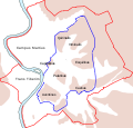
Barkas:Roma Plan.jpg

Gedhéning pratuduh iki: 754 × 600 piksel Résolusi liya: 302 × 240 piksel | 604 × 480 piksel | 966 × 768 piksel | 1.280 × 1.018 piksel | 1.840 × 1.463 piksel.
Berkas asli (1.840 × 1.463 piksel, ukuran barkas: 2,5 MB, jinis MIME: image/jpeg)
Sajarahing berkas
Klik ing tanggal/wektuné saprelu ndeleng rupané barkasé nalika tanggal iku.
| Tanggal/Wektu | Gambar cilik | Alang ujur | Naraguna | Tanggepan | |
|---|---|---|---|---|---|
| saiki | 30 Maret 2015 16.14 |  | 1.840 × 1.463 (2,5 MB) | Jonstevn | Reverted to version as of 19:01, 28 August 2006 |
| 30 Maret 2015 16.10 |  | 1.840 × 1.463 (2,5 MB) | Jonstevn | Reverted to version as of 19:01, 28 August 2006 | |
| 30 Maret 2015 16.10 |  | 1.840 × 1.463 (2,5 MB) | Jonstevn | Reverted to version as of 19:01, 28 August 2006 | |
| 27 Juli 2008 06.40 |  | 1.840 × 1.463 (3,38 MB) | Amadscientist | {{Information |Description= |Source= |Date= |Author= |Permission= |other_versions= }} | |
| 27 Juli 2008 04.57 |  | 4.000 × 3.180 (12,21 MB) | Amadscientist | {{Information |Description= |Source= |Date= |Author= |Permission= |other_versions= }} | |
| 28 Agustus 2006 19.01 |  | 1.840 × 1.463 (2,5 MB) | Nikephoros | {{Information |Description=Plan Roms im Altertum / Map of Rome during Antiquity |Source=G. Droysens Allgemeiner Historischer Handatlas |Date=1886 |Author=? |Permission= not needed |other_versions= no }} |
Panggunaning berkas
2 kaca ing ngisor iki nganggo barkas iki:
Panggunané barkas sajagat
Wiki liya ngisor iki nganggo barkas iki:
- Kanggo ing ar.wikipedia.org
- Kanggo ing as.wikipedia.org
- Kanggo ing azb.wikipedia.org
- Kanggo ing beta.wikiversity.org
- Kanggo ing bg.wikipedia.org
- Kanggo ing bn.wikipedia.org
- Kanggo ing bs.wikipedia.org
- Kanggo ing bxr.wikipedia.org
- Kanggo ing ca.wikipedia.org
- Kanggo ing ceb.wikipedia.org
- Kanggo ing cs.wikipedia.org
Deleng naraguna liyané sadonya saka kaca iki.


